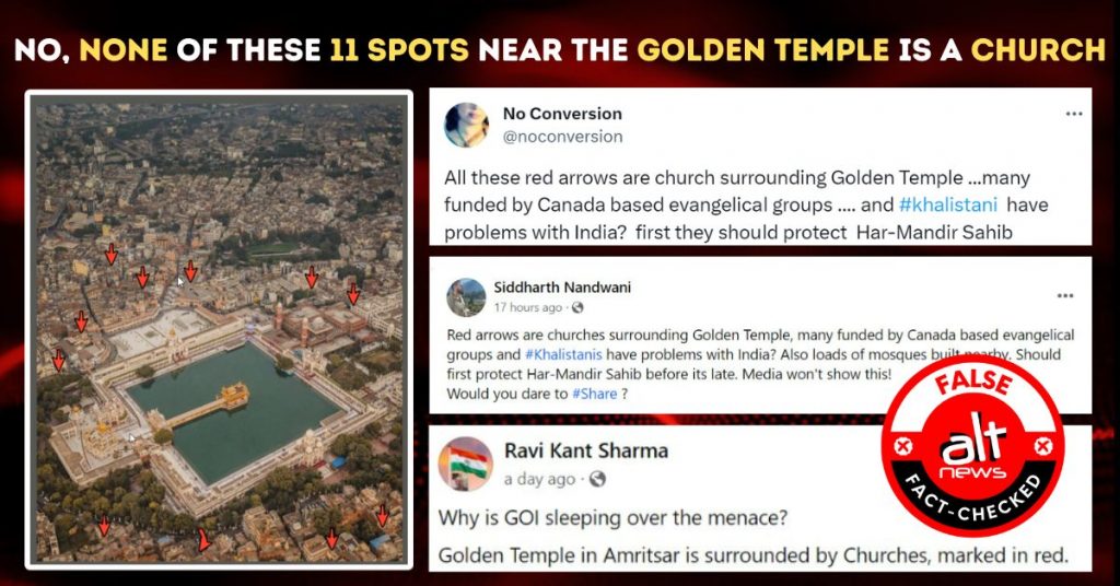
An image showing an aerial view of the Golden Temple in Amritsar is being shared widely on social media with users claiming that there are 11 churches around the Golden Temple complex that are funded by Canada. These churches have been earmarked in the photo with red arrows.
X (formerly Twitter) user ‘No Conversion’ (@noconversion) shared the above-mentioned image on January 8 with the following caption: “All these red arrows are church surrounding Golden Temple …many funded by Canada based evangelical groups …. and #khalistani have problems with India? first they should protect Har-Mandir Sahib”. The tweet has received over 2.4 Lakh views and has been retweeted over 3,300 times. (Archive)
All these red arrows are church surrounding Golden Temple …many funded by Canada based evangelical groups …. and #khalistani have problems with India? first they should protect Har-Mandir Sahib pic.twitter.com/s0zydeRQvX
— No Conversion (@noconversion) January 8, 2024
In another tweet from the same day, the user @noconversion shared the above image with a picture of the Google Maps view that shows the churches near the Golden Temple.
@unitedsikhs @SikhFedUK @WorldSikhOrg @SGPCAmritsar @SGPCPresident … all these red arrows are Christian church right next to Golden Temple pic.twitter.com/1g1PLVxZQF
— No Conversion (@noconversion) January 8, 2024
Several other users shared the viral image with the same claim on X and Facebook.
Fact Check
To check the authenticity of the claim we geolocated each of the eleven points using Google Maps.
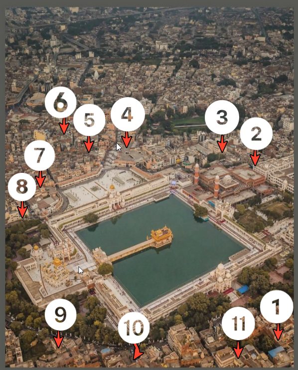
Point 1:
The first location pointed out in the viral photo shows a building with a blue roof. Using Google Maps, we looked into the pointed building and found that it’s a general store called Arora Boutique Metteral, not a church. The distance between the store and the temple is about 350 metres.
Point 2:
The second arrow points at the roof of a sprawling brick-red building. The building is at the edge of the lake next to the Golden Temple making the two structures face each other. Two tall towers can be seen on one side of the brick-red building. On checking Google Maps, we found that the building in question is the ‘Langar Hall’ or community kitchen at the Golden Temple complex. The Langar Hall is the world’s largest community kitchen which provides free food to nearly 1,00,000 people every day. The kitchen is attached to the Sri Harmandir Sahib Gurdwara.
The Golden Temple’s official website also marked the building as the Community Kitchen or the ‘Langar Hall’. The two tall towers of the structure are also visible in the image shared on the Gurdwara’s official website.
Point 3:
The third arrow does not specifically point to a building but rather an area between ‘Langar Hall’ and bushes on the periphery of the Gurudwara. We checked the buildings in that area as could be viewed on Google Maps and found that the area consists of general stores, guest houses, restaurants, public toilets and a water tank.
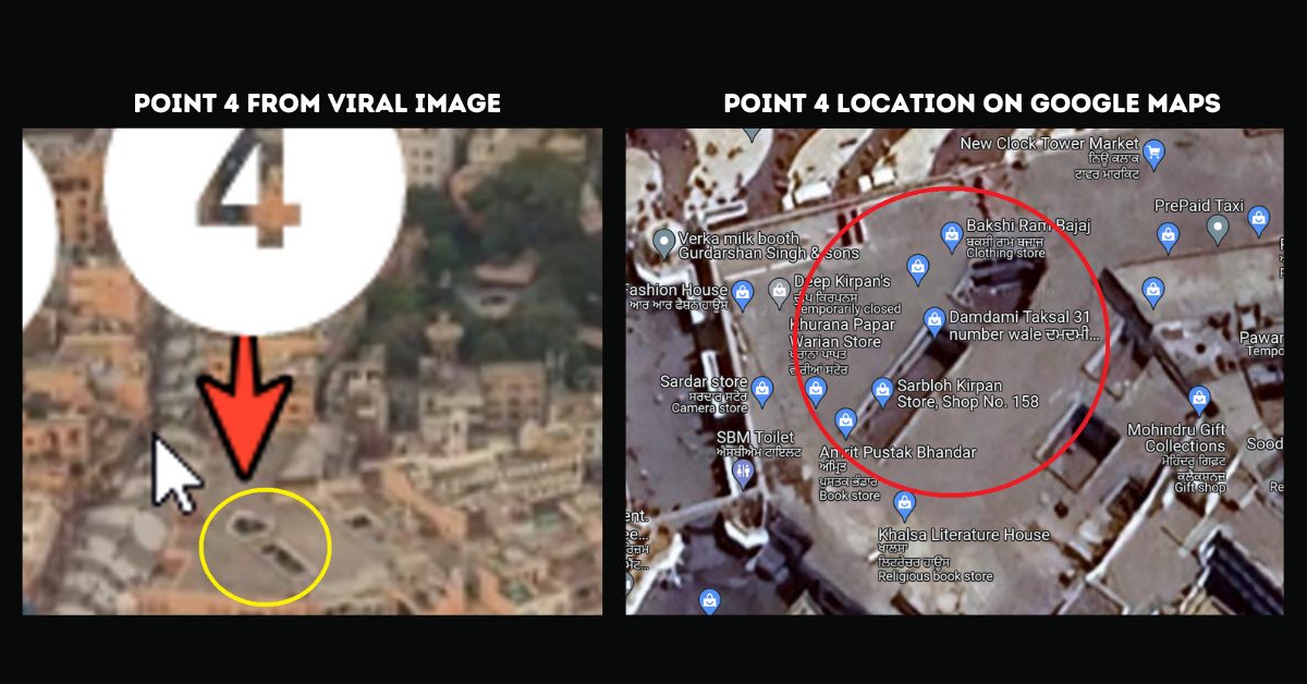
Point 4:
The fourth arrow points to a pattern which is not clearly visible in the viral image. We noticed a similar one on Google Maps. We found that the area mentioned as the fourth point consisted of stores for clothing, literature and religious books, as can be seen in the image below and the Damdami Taksal, a Sikh cultural and educational organisation. No churches can be seen in and around the vicinity of the marked area.
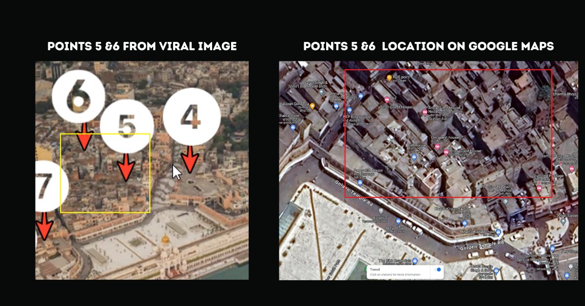
Points 5 and 6:
Similarly, we looked into the areas marked as five and six on Google Maps and found that the area consisted of guest houses and hotels, but no churches.
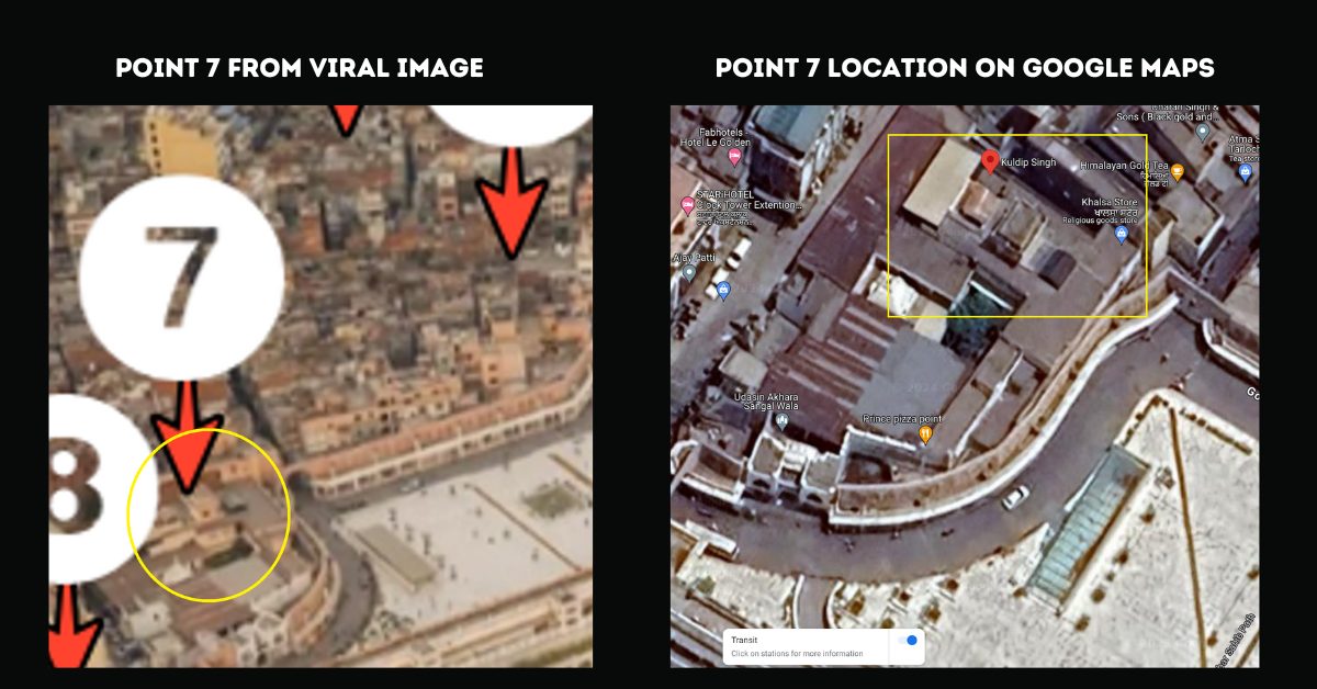
Point 7:
We checked the area marked as No 7 in the viral image on Google Maps. It can be seen in the image below that the right corner of the is the Khalsa Store, a religious goods store, and the left corner is marked on Google Maps as ‘Kuldip Singh’, which is a tourist attraction place. However, again, no churches can be found in that area. The area is about 250-metre from the Gurudwara.
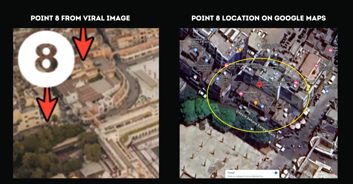
Point 8:
On checking the area marked as No 8 in the viral image, we found that it consisted of hotels, a general store, a clothing store and an eatery. Readers can see the same in the image below as on Google Maps. This area is about 120 metre from the Golden Temple.
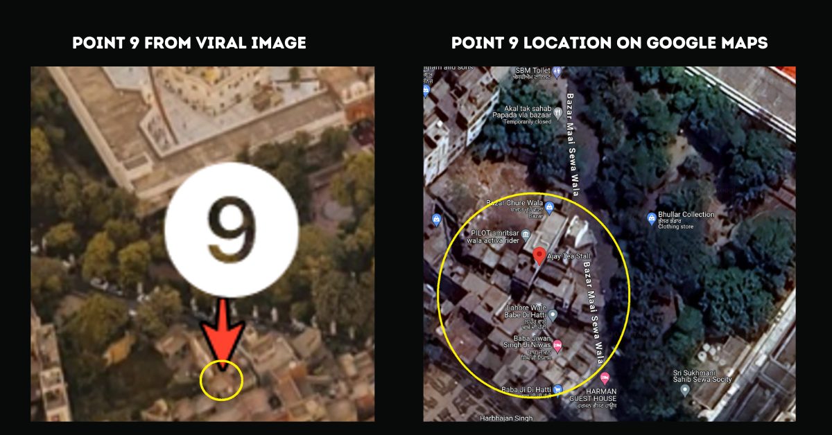
Point 9:
We could not check the specific building marked as nine in the viral image, but we checked the area around it on Google Maps. The area consisted of various kinds of stores as can be seen in the image attached below. This area is about 110 metre from the Golden Temple.
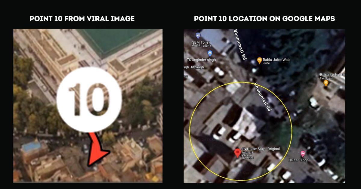
Point 10:
We looked into the point marked as No 10 on Google Maps and found that this had a home stay called 4N Home Stay – Original. The homestay is about 180 metre from the Gurudwara.
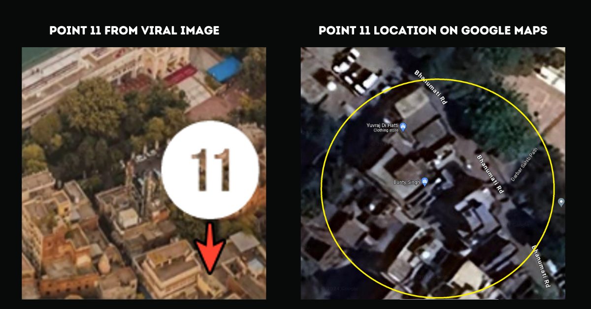
Point 11:
While we could not find the specific building marked as No 11, we checked the area on Google Maps and could not find any churches. The area only consisted of shops and business establishments. This point is around 280 metre from the Sri Hamandir Sahib temple.
Hence, contrary to the viral claim, none of the 11 points around the Golden Temple complex marked in the viral image is a church.
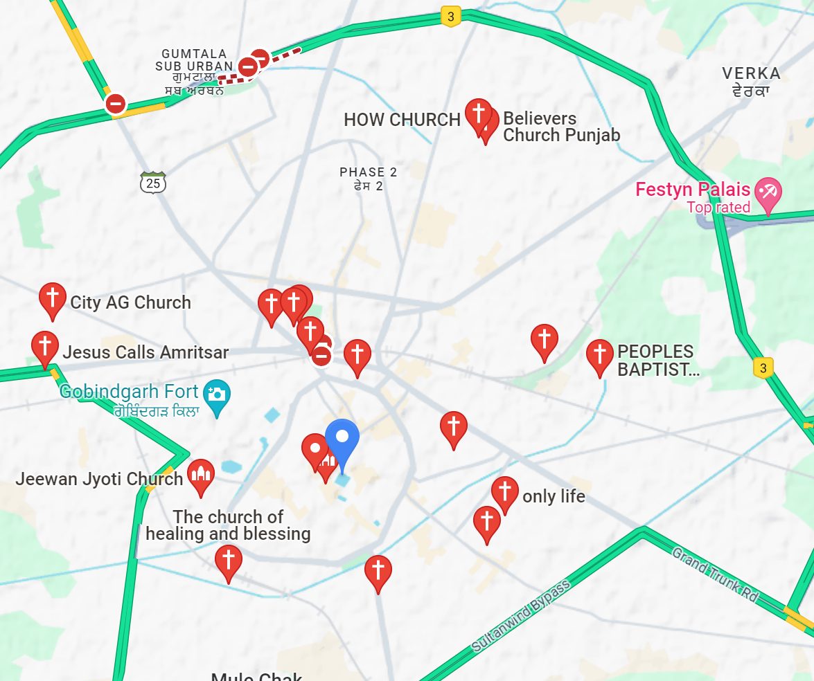
We also looked into the other image of Google Maps shared by user @noconversion which shows the names of several churches apparently around the Golden Temple.
On searching on Google Maps about the churches near The Golden Temple we came across a similar visual as in the viral image, in the zoomed-out view.
The fact is that the church nearest to the Golden Temple is the Jeevan Jyoti Church, 280 metre away. It is not in the immediate vicinity of the temple complex.
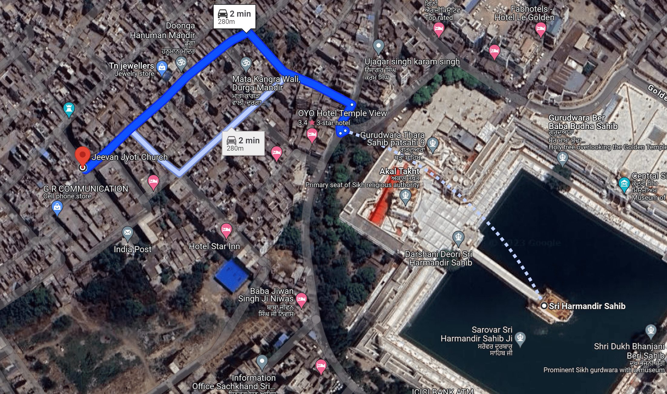
When one zooms in on the area around the Temple in Google Maps, it becomes clear that other than Jeevan Jyoti Church, the rest were all at least 2 kilometre away from the Golden Temple. This can be seen in the video below. In the zoomed-out view, one gets the illusion that the churches are in close proximity to the Golden Temple complex. This is not the case in reality.